Discover how Trimble’s mobile mapping systems and Trimble Business Center 2024 can revolutionize geospatial data collection and analysis for road asset management, city planning, and more.
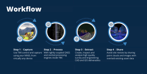
Trimble’s mobile mapping systems represent a breakthrough in geospatial data collection and analysis. Integrating advanced sensors like LiDAR, cameras, and GNSS receivers on moving vehicles, these systems gather high-resolution data over extensive areas. Ideal applications include road and rail asset management, city planning, and infrastructure maintenance.
Comparing Trimble’s Mobile Mapping Solutions
Trimble offers several mobile mapping systems, each with unique strengths:
- MX90: Excels in high-precision tasks such as road and rail asset management, telecommunication inventories, and 3D city modeling.
- MX50: Balances accuracy and versatility, making it perfect for managing highway utilities and city assets.
- MX7: Specializes in capturing immersive panoramic images and GIS data, ideal for creating city maps and conducting change analyses over time.
Trimble Business Center (TBC) 2024: Enhancing Mobile Mapping
Trimble Business Center 2024 enhances Trimble’s mobile mapping systems with a suite of advanced features designed for geospatial professionals:
- Real-time Scan Generation: Generate and update scans on demand, allowing you to view scans immediately and choose the best fit for your project needs.
- Temporary File Management: Store temporary files according to the processes that generated them, ensuring efficient data management.
- Crash Recovery: Recover previously processed scans, minimizing data loss and project disruptions.
- International Roughness Index (IRI) Reporting: Monitor pavement surface irregularities that affect ride quality, aiding in project planning and maintenance.
- Feature Service Connection: Enhance data sharing capabilities between data providers and consumers, facilitating seamless integration and collaboration.
- Pavement Inspection Lifecycle Management: Manage the entire lifecycle of pavement inspections, from data capture to analysis, with integration into agile assets.
- Railway Classification: Utilize a 3D learning model to classify points into rail sleeper and ballast, improving the accuracy and efficiency of railway assessments.
- Advanced Point Cloud Filtering: Apply elevation-based filtering for common use cases, including downsampling dense point clouds and separating low grass from the ground. Optimize performance for large mobile mapping datasets.
Trimble’s mobile mapping systems, coupled with the powerful features of TBC 2024, provide a robust solution for professionals in the geospatial field. Whether managing road assets, conducting volumetric analyses, or creating 3D city models, these tools enable smarter, faster, and more accurate workflows.
Contact us to learn more about how Trimble’s mobile mapping solutions can transform your field operations.