This next-generation drone platform is revolutionizing operations in many industries; its advanced features and robust design make it an essential tool for aerial applications.
In an era where technology advances continuously, surprising us with its ability to make tasks more efficient and effective, the DJI Matrice 350 emerges as a game-changer. This professional drone combines groundbreaking technology with robust features, transforming operations in agriculture, construction, inspections, security and mapping (to mention a few). With a revolutionary video transmission system, an efficient battery system, and comprehensive safety features, it sets a new standard for excellence. Let’s explore how it can be utilized across different industries.
Agriculture: precision and efficiency in farming
Imagine a world where farmers can monitor their crops with pinpoint accuracy, detect diseases early and optimize their use of water and fertilizers, with a drone that features powerful propulsion and enhanced protection ratings:
- Precision monitoring: with the O3 Enterprise Transmission system, it provides triple-channel 1080p HD live feeds and a maximum transmission distance of 20 km. Farmers can now receive real-time, high-definition insights into their fields, allowing for immediate action on crop health issues.
- Optimized soil analysis: the drone’s capability to carry up to three payloads simultaneously, including multispectral and thermal sensors, enables precise monitoring of soil conditions and crop health. The aircraft also features an open E-Port interface and a maximum payload capacity of 2.7 kg, facilitating targeted interventions.
Construction: revolutionizing site management
In the construction industry, staying on top of site progress and ensuring safety is paramount. This device’s robust design and advanced features provide unparalleled support:
- Accurate surveying: equipped with RTK precision, it can create detailed topographical maps and 3D models of construction sites, aiding in meticulous planning and design.
- Monitoring: with the DJI RC Plus controller, featuring a 7-inch high-bright screen and Dual Operator Mode, construction managers can monitor site progress in real-time, ensuring projects stay on track. Additionally, the drone’s six-directional sensing and positioning system, combined with night-vision FPV cameras, allows for comprehensive safety inspections, even in challenging conditions.
Mapping: precision and efficiency
Mapping and geospatial professionals rely on accurate data collection and efficient processing. The M350 RTK excels in these areas:
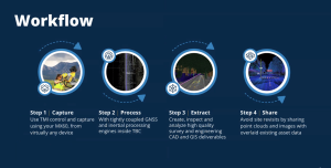
- High-precision mapping: with support for various mission types, including Waypoint, Mapping and Oblique flights, it can quickly gather data and generate high-definition 2D and 3D maps.
- Comprehensive data management: the integration with DJI Terra and DJI FlightHub 2 allows for seamless data processing and real-time collaboration, enhancing the efficiency of mapping operations.
The DJI Matrice 350 RTK is not just a drone; it’s a transformative tool that empowers professionals across industries. Its powerful propulsion, enhanced protection, and advanced transmission systems make it an indispensable asset, by integrating these cutting-edge features, it enables users to tackle a wide variety of challenges with confidence and ease, setting a new standard for what is possible with drone technology.
Contact HLCM Group and invest in the future of your industry today.