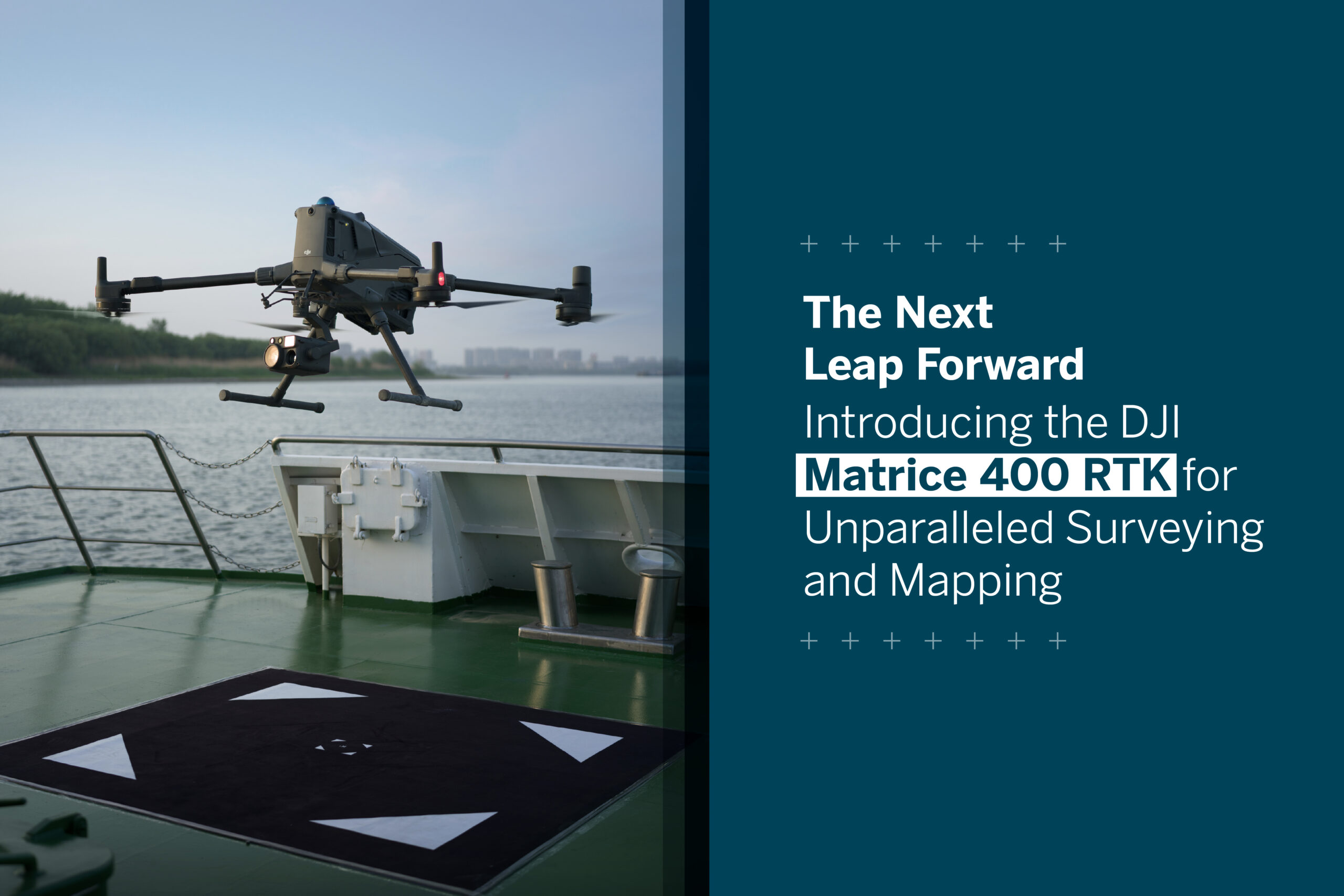
The Next Leap Forward: Introducing the DJI Matrice 400 RTK for Unparalleled Surveying and Mapping

HLCM Trimble Matrice 400 RTK

The world of geospatial data collection is in a constant state of evolution, with new technologies continually pushing the boundaries of what’s possible. For professionals in surveying, engineering, and construction, staying at the forefront of this evolution is not just an advantage; it’s a necessity. At HLCM, we are committed to equipping our clients with the most advanced tools to enhance their efficiency, accuracy, and safety. Today, we are thrilled to introduce a true game-changer: the DJI Matrice 400 RTK.

Building on the legacy of its predecessors, the Matrice 400 RTK represents a significant leap forward in drone technology. This is not just an incremental update; it’s a redesigned platform engineered to tackle the most demanding projects with unprecedented power and intelligence.

Redefining Performance and Endurance

One of the most significant advancements of the Matrice 400 RTK is its enhanced flight performance. With a maximum flight time of up to 59 minutes, this drone allows for extended operations, enabling the coverage of vast areas without the need for frequent battery swaps. This extended airtime, coupled with a higher operational ceiling, means more data can be captured in a single flight, streamlining fieldwork and maximizing productivity.

Furthermore, the Matrice 400 RTK boasts an impressive maximum payload capacity of 6 kg (13.2 lbs). This substantial increase opens the door for a wider range of high-performance sensors and even multi-payload configurations, allowing for the simultaneous collection of diverse datasets from DJI and third-party payloads.

Compatible payloads include:

  • Zenmuse H30: Multi-sensor for all-weather day/night imaging
  • Zenmuse L2: Frame-based LiDAR for high-precision mapping
  • Zenmuse P1: Full-frame sensor for photogrammetry
  • Zenmuse S1: High-brightness spotlight using LEP laser technology
  • Zenmuse V1: Loudspeaker with long broadcast range
  • Manifold 3: Embedded computer for advanced processing

Multiple third-party payloads e.g., YellowScan LiDAR, MicaSense Multispectral and more.

A New Era of Obstacle Sensing and Safety

Navigating complex environments is a daily reality for surveyors and mapping professionals. The Matrice 400 RTK addresses this challenge with a revolutionary obstacle sensing system. For the first time, a commercial drone integrates both rotating LiDAR and millimeter-wave (mmWave) radar. This fusion of technologies provides unparalleled awareness, enabling the detection of small and hard-to-see obstacles like power lines, even in low-light or adverse weather conditions. This multi-layered approach to safety provides pilots with the confidence to operate in challenging terrains, minimizing risks and protecting valuable equipment.

The robust airframe of the Matrice 400 RTK also features an IP55 rating, ensuring its resilience against dust and water ingress, making it a reliable tool in a variety of environmental conditions.

Superior Data Transmission and Control

Maintaining a stable and clear connection with the aircraft is paramount for mission success. The Matrice 400 RTK incorporates the new DJI O4 Enterprise transmission system, offering a robust and reliable link between the drone and the controller. This advanced system provides a triple-channel 1080p HD live feed and supports a transmission distance of up to 20 kilometers, ensuring a clear and consistent view of the operational area, even at extended ranges.

The HLCM Advantage

The arrival of the DJI Matrice 400 RTK marks a pivotal moment for the geospatial industry. Its advanced capabilities in flight performance, payload capacity, and safety will undoubtedly set a new standard for aerial surveying and mapping.

At HLCM, we understand that integrating new technology into your workflows requires expertise and support. Our team of professionals are here to guide you through every step of the process, from selecting the optimal payload configuration for your specific needs to providing comprehensive training and ongoing technical support. We are dedicated to ensuring you harness the full potential of the Matrice 400 RTK to achieve your project goals with greater efficiency and accuracy than ever before.

Ready to elevate your surveying and mapping capabilities? Contact HLCM today to learn more about the DJI Matrice 400 RTK and how it can transform your operations.

Contact us today at sales@hlcmgroup.com or call us at 787-998-1192. You can also visit our website at www.hlcmgroup.com to explore all our solutions.

Follow us on social media to stay informed and connected:  LinkedInFacebook, and Instagram.


Trusted technology to transform infrastructure in Puerto Rico and the Caribbean

In recent years, the Caribbean has faced numerous challenges, from natural disasters to infrastructure vulnerabilities. As the region works to rebuild and strengthen its essential systems, the integration of advanced geospatial technologies has become critical. At the forefront of this transformation is HLCM, an authorized Trimble distributor, delivering trusted solutions backed by local expertise, comprehensive training, and ongoing support to help communities build smarter, more resilient infrastructure.

The urgency of resilient infrastructure

Across the Caribbean, including Puerto Rico and its neighboring islands, communities have experienced the devastating impacts of hurricanes and other extreme weather events. These experiences have highlighted the urgent need for robust infrastructure that can withstand such challenges. Modernizing infrastructure is not just about rebuilding—it’s about reimagining systems that are adaptable, efficient, and sustainable.

Leveraging Trimble technology through HLCM

As an authorized distributor of Trimble, HLCM provides professionals in the Caribbean with access to advanced tools tailored to meet the region’s unique infrastructure needs:

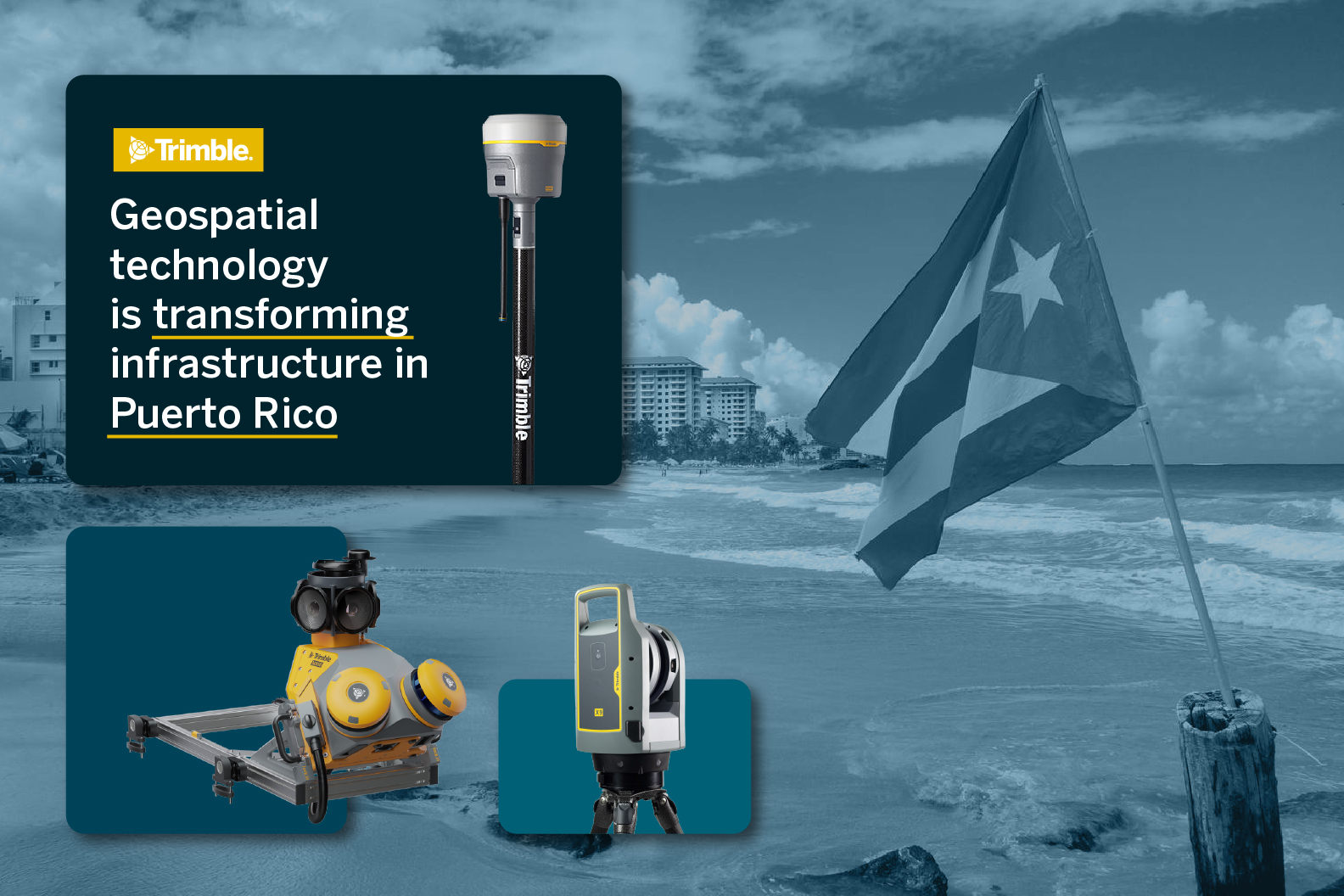
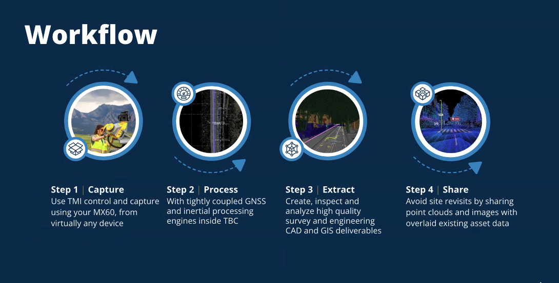
  • Trimble MX60 Mobile Mapping System – Enables rapid and accurate data collection, essential for planning and monitoring infrastructure projects. Its mobility ensures precise surveys even in remote areas.
  • Trimble X9 3D Laser Scanner – Offers high-resolution 3D scans vital for assessing structural integrity and planning renovations or new constructions with unmatched detail.
  • Trimble R980 GNSS Receiver – Delivers reliable, high-precision positioning data, helping infrastructure projects achieve accuracy and efficiency.
  • Trimble DA2 GNSS Receiver with Catalyst technology – Brings high-accuracy positioning to more users, enabling better decision-making in infrastructure development.

Real-world impact: a case study in Puerto Rico

In Puerto Rico, the Department of Housing launched a mobile cartography project aimed at enhancing disaster resilience. Using the Trimble MX60, the team collected comprehensive geospatial data to support infrastructure improvements. This initiative demonstrates how trusted technology—delivered by HLCM—can bring tangible benefits to communities.

The advantage of a trusted brand

Choosing HLCM means investing in reliability, accuracy, and innovation. Our commitment to delivering certified geospatial solutions ensures that infrastructure projects are not only successfully completed, but also built to last.

Ready to build a resilient future?

Discover how HLCM can support your infrastructure projects with trusted technology. Whether you’re planning large-scale developments or focused upgrades, our solutions are designed to deliver performance you can rely on.

Contact us today at sales@hlcmgroup.com or call us at 787-998-1192. You can also visit our website at www.hlcmgroup.com to explore all our solutions.

Follow us on social media to stay informed and connected: LinkedInFacebook, and Instagram.

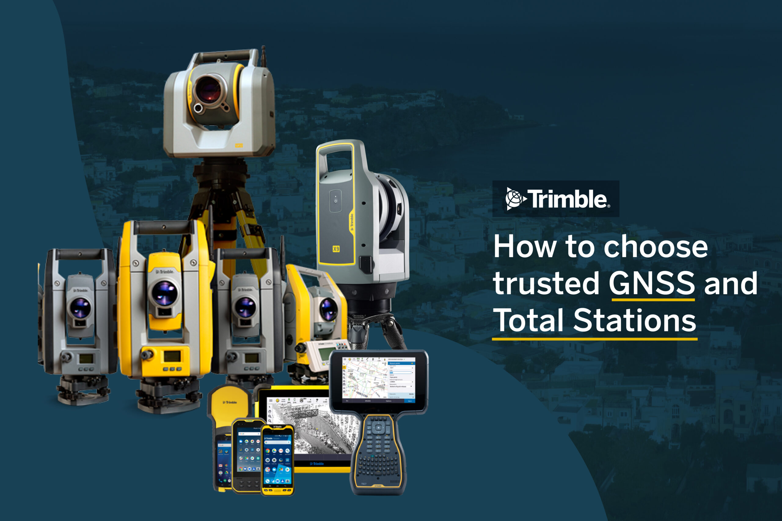
How to choose trusted GNSS and Total Stations

  • Precision, reliability, and support that make the difference

In the world of surveying, engineering, and geospatial mapping, the equipment you choose is more than just a tool—it’s the foundation of every decision, every plan, and every result. Whether you’re working on topographic surveys, construction layouts, or cadastral mapping, having a trusted GNSS receiver or Total Station means more than just accurate data—it means confidence in every step of your workflow.

At HLCM, we believe that trust begins with choosing the right equipment. Backed by leading brands like Trimble and Spectra Precision, our solutions are designed to provide real results where precision and dependability matter most.

What makes a GNSS or total station truly “trusted”?

With so many options on the market, it can be challenging to determine which solution best meets your project’s needs. Here are the essential factors to consider when choosing GNSS systems or Total Stations:

Field-proven accuracy and performance

When your data is the backbone of decision-making, accuracy is non-negotiable. Look for GNSS receivers and Total Stations that offer:

  • Centimeter-level precision

  • Strong satellite tracking (even in difficult environments)

  • Advanced optical or EDM technology for distance and angle measurements

  • Trimble’s R980 GNSS and Spectra SP100 provide high performance under diverse field conditions—proven in hundreds of real-world projects.

Ease of use and integration

Professionals require equipment that adapts to their workflow—not the other way around. Trusted tools are:

  • Easy to deploy and configure

  • Compatible with Trimble Access, Trimble Business Center, and more

  • Built for field-to-office integration, reducing time and errors

The Trimble C5 Total Station and DA2 GNSS receiver are known for their intuitive interfaces and seamless software compatibility.

Durability in harsh environments

Surveying doesn’t always happen under perfect conditions. That’s why it’s crucial to choose instruments that are:

  • Weather-resistant and rugged

  • Designed for long field sessions

  • Supported with reliable transport cases and mounting accessories

HLCM equips its kits with carbon fiber tripods, reinforced backpacks, and all-weather accessories to keep your tools secure.

Support and training you can count on

Even the best equipment is only as good as the support behind it. Look for a provider that offers:

  • Expert technical support and warranties

  • Hands-on training for your team

  • Access to updates, maintenance, and system optimization

At HLCM, we don’t just provide equipment—we offer partnerships. From setup to advanced training, our specialists ensure your team gets the most out of your investment.

Why choose HLCM? Trusted brand, trusted results

Choosing HLCM means choosing a Trimble Certified Partner that puts professionals first. We understand the needs of modern surveyors and engineers, and we’re committed to helping you:

  • Achieve greater precision and efficiency

  • Build repeatable, reliable workflows

  • Stay ahead with the latest GNSS and Total Station technology

With HLCM, you’re not just buying tools—you’re investing in a trusted brand backed by real results.

Ready to upgrade your surveying equipment?

If you’re looking for a GNSS receiver or Total Station that performs under pressure, integrates with your software, and comes with expert support, HLCM has the solution you need.

📞 Contact us today: 787-998-1192
sales@hlcmgroup.com
🌐 hlcmgroup.com

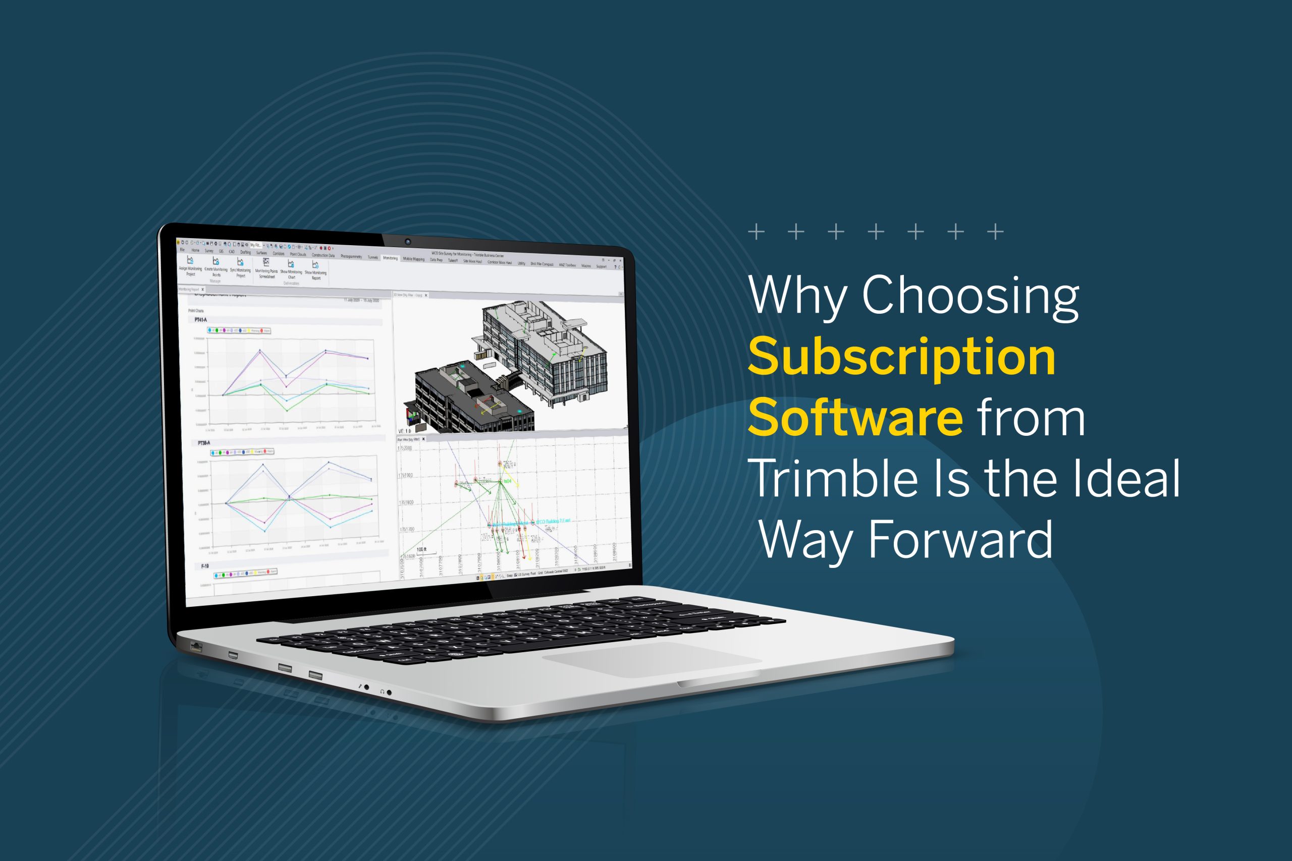
Why Choosing Subscription Software from Trimble Is the Ideal Way Forward

Stay Ahead with Innovation, Reliability, and Expert Support

In today’s fast-paced surveying and geospatial industry, having access to the latest technology and software updates is essential to ensuring precision, efficiency, and seamless workflows.

Trimble’s subscription-based software model offers a flexible, cost-effective solution that empowers professionals with the tools they need to succeed.

At HLCM, we provide trusted solutions that enhance your projects with cutting-edge technology and expert support, ensuring you always have access to the best tools for your work.

1. Why Subscription Software? Flexibility, Cost-Efficiency & Continuous Innovation

Traditional software licensing can often involve high upfront costs and manual updates, limiting access to new features and security improvements. Trimble’s subscription model provides a smarter way forward, offering:


    • Lower Initial Investment – Access professional-grade software without large upfront costs.

    • Always Up-to-Date Technology – Automatic updates ensure you’re always working with the latest tools.

    • Scalability for Any Project – Choose the right plan based on your project needs.

    • Cloud Integration & Real-Time Collaboration – Work seamlessly across teams and devices.

A subscription-based model isn’t just about affordability—it’s about ensuring that you always have the best technology at your fingertips.

2. How Trimble Subscription Software Enhances Your Workflow

Using Trimble’s advanced software solutions, surveyors and geospatial professionals can optimize every stage of their work, from data collection to final analysis.


    • Seamless Integration – Compatible with Trimble GNSS receivers, Total Stations, and Mobile Mapping solutions.

    • Enhanced Data Accuracy – Access real-time processing and advanced mapping tools to improve precision.

    • Optimized Project Management – Work efficiently with features designed to streamline field-to-office workflows.

    • Secure & Scalable Solutions – Cloud-based access ensures data security and easy collaboration.

With Trimble’s subscription model, you get more than just software—you gain a complete solution designed to optimize your operations.

3. Trusted Brand: Why HLCM Is Your Best Partner

At HLCM, we don’t just provide technology—we build long-term relationships with professionals who demand precision, efficiency, and reliability. As a Trimble Certified Partner, we offer:


    • Genuine Trimble Solutions – Certified software and hardware to guarantee performance.

    • Ongoing Technical Support – A team of experts ready to assist whenever needed.

    • Training & Optimization – Helping you maximize your investment and efficiency.

    • Seamless Integration with Trimble Equipment – Designed for surveyors, engineers, and geospatial professionals.

Choosing HLCM means working with a trusted partner committed to your success.

4. Make the Smart Choice: Upgrade to Trimble Subscription Software Today

Stay ahead of the curve with Trimble’s industry-leading technology and HLCM’s expert support. With a subscription-based model, you’ll always have access to the latest innovations, ensuring your projects are executed with maximum precision and efficiency.

The geospatial industry is evolving rapidly, and staying competitive requires access to the latest technology, continuous updates, and seamless integration with professional-grade hardware. Trimble’s subscription-based software provides the flexibility, cost-efficiency, and reliability that modern surveyors and geospatial professionals need.

By choosing HLCM as your technology partner, you gain access to certified solutions, expert support, and a trusted brand that ensures your projects are executed with unmatched precision and efficiency.

Upgrade to Trimble Subscription Software today and experience the future of surveying technology. Stay up to date with this and other industry insights by following us on social media: LinkedIn, Facebook, and Instagram.

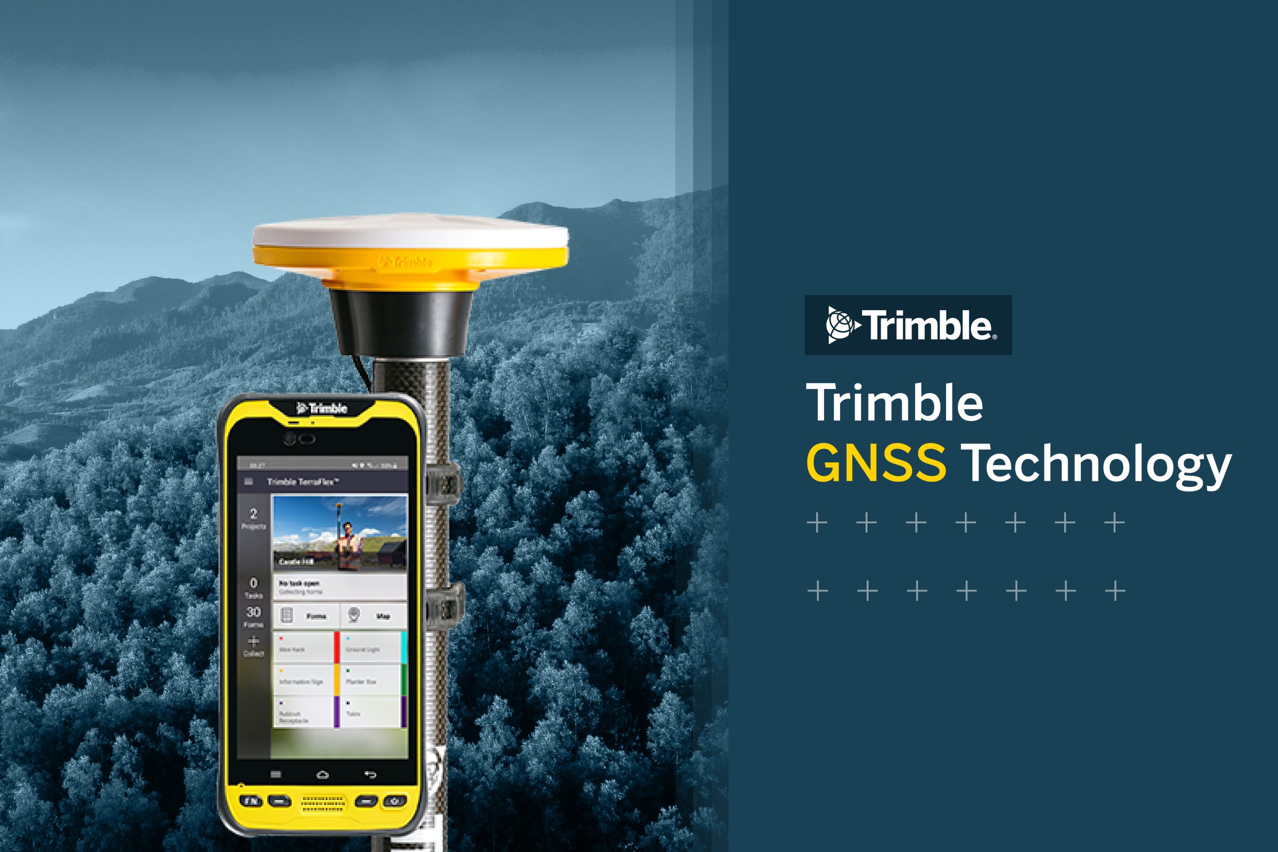
Trimble GNSS Technology: The Key to Accurate and Reliable Measurements

Trimble’s GNSS systems provide an advanced solution for surveying and geographic information system (GIS) professionals, delivering precision and reliability in geospatial data collection. At HLCM Group, we are distributors of this world-class technology and offer multiple advantages designed to transform how geospatial information is gathered and analyzed.

Continue reading